.jpg "Refining Hai Phong master plan toward marine megacity")
.jpg "Hai Phong announces adjustment to city master plan for 2021-2030 period, vision to 2050")

Gửi bình luận
The effectiveness of planning adjustments is reflected not only in the area of land converted but also in proper usage, synchronized infrastructure, on-schedule project implementation, and improved residents’ quality of life.
.jpg)
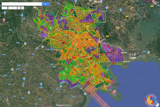
The Hai Phong People’s Committee has approved partial adjustments to the city Master Plan to 2040, with a vision to 2050, and the Master Plan for the new Thuy Nguyen urban area to 2045.
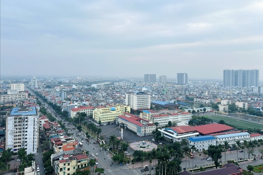
The adjustment covers the wards of Hong Bang, An Duong, An Hai, Hoa Binh, Bach Dang, Luu Kiem, Thien Huong, Thuy Nguyen and Nam Trieu. These are areas undergoing rapid urbanization, with a concentration of infrastructure projects and land reserves capable of creating new development momentum.
The total area subject to adjustment under the Hai Phong Master Plan is 1,000.8 hectares, comprising 12 locations. The land-use structure is rearranged toward increasing land for mixed-use purposes, urban services, commerce, logistics, schools, transportation and greenery.
The focus of this adjustment is the area of the former Thuy Nguyen city’s administrative and political center, now located in the wards of Hoa Binh, Bach Dang and Luu Kiem, covering 659.7 hectares. After the adjustment, the area will have 112 hectares of residential land; 73.3 hectares of mixed-use land; 38.8 hectares of public and urban service land; 11.8 hectares of commercial, service and logistics land; 5.9 hectares of high school land; and 92.3 hectares of transportation land.
The city authorities also adjusted the Master Plan for the new Thuy Nguyen urban area over an area of 543.8 hectares in the three wards mentioned above. The simultaneous adjustment of the two plans will help unify land-use functions, creating a basis for formulating subdivision and detailed plans and implementing projects.
Notably, the conversion of land at some locations will not reduce the overall urban green-space target. After the adjustments, urban green space within the 1,000.8-hectare area will reach 298.7 hectares, an increase of 3.2 hectares.
The partial adjustment of the general planning in the nine wards is a necessary step for Hai Phong to remove bottlenecks and make effective use of its land reserves. The planning adjustment also updates Ring Road 3; adds a road along the Gia river and connecting routes; adjusts urban railway routes and depots; and completes systems for electricity supply, water supply, and rainwater and wastewater drainage.
As the organizational structure, land-use needs and investment orientations change, planning contents that are no longer appropriate must be reviewed and updated. If adjustments are delayed, planning can become a bottleneck, resulting in wasted land and delayed project implementation.
Every additional area of residential or mixed-use land creates corresponding demand for transportation, schools, healthcare and technical infrastructure. If land-use functions are changed without infrastructure investment keeping pace, an old bottleneck may be removed while a new one emerges.
Therefore, the City People’s Committee requires the Department of Construction to take responsibility for current-status data, publicly disclose the collection of opinions, update planning documents and announce all contents of the adjustment. The new planning must not increase pressure on the area’s technical and social infrastructure.
The effectiveness of a planning adjustment decision should not be measured only by the area of land converted. More important measures are whether land reserves are used for the right purposes, infrastructure is developed synchronously, projects are implemented on schedule, and residents’ quality of life is improved.
BAO NAM