Hai Phong rebuilds agricultural land database
More than 90% of agricultural land plots in Hai Phong are currently being used in ways that do not match the information recorded in the land registration system and cadastral maps.
.jpg)
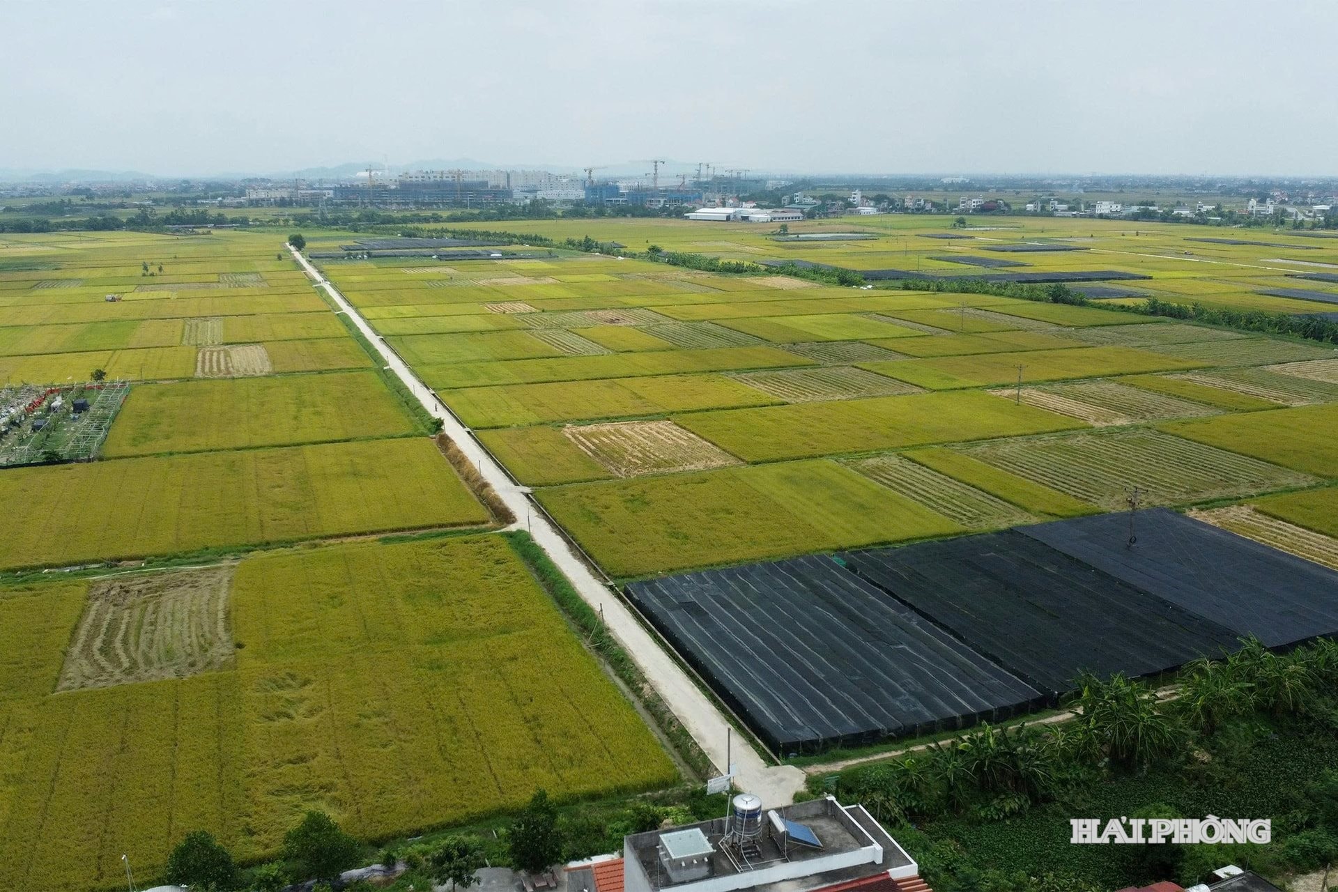
Fragmented data, out of sync with reality
Ms. Nguyen Thi Lan, a resident of Hamlet 3 in Nghi Duong Commune, said that her family completed land consolidation and exchange more than ten years ago. However, they have still not been issued a new land-use right certificate reflecting the changes and continue to use the certificate originally granted under Government Decree No. 64 dated September 27, 1993.
Similarly, Mr. Pham Van Thuan of Cam Khe Hamlet, Tan Minh Commune, explained that after land consolidation, his family's four to five scattered plots across different fields were merged into a single plot of more than 1,000 square meters. Despite this, the family has yet to receive a land-use right certificate for the consolidated agricultural land.
In the areas that previously belonged to Thuy Nguyen District, official records show more than 200,000 agricultural land parcels. In reality, however, only about 80,000 parcels currently exist.
According to Duong Dinh On, Deputy Director of the Department of Agriculture and Environment, communes across the city began implementing land consolidation and exchange in 2012 to address fragmented landholdings, establish specialized production zones, facilitate agricultural mechanization, and enable farmers to adopt scientific and technological advances in production.
However, the issuance of new land-use right certificates after land consolidation has been significantly delayed. Changes in agricultural land ownership and usage have not been updated or adjusted on cadastral maps, resulting in discrepancies between cadastral records and actual land use.
A preliminary survey conducted by the Land Registration Office under the Department of Agriculture and Environment found that more than 90% of the land-use right certificates issued to agricultural households no longer match current land-use conditions.
Following land consolidation, the location, number, and size of land parcels owned by households and individuals have changed. As a result, the information recorded on previously issued certificates is no longer accurate, and the old certificates do not reflect the current situation on the ground.
At the same time, the storage, updating, and correction of land-use changes have not been carried out in accordance with regulations.
Re-measurement and standardization of data
Mr. Le Quang Hung, Deputy Director of the Land Registration Office (Department of Agriculture and Environment), said that on April 13, 2026, the Ministry of Agriculture and Environment and the Ministry of Public Security jointly issued Plan No. 2959 to strengthen cadastral surveying, cadastral mapping, cadastral record preparation, and the completion of the national land database.
Plan 2959 aims to ensure that 100% of land parcels across the city are digitized and incorporated into the land database by the end of 2026. Given the current state of agricultural land management, re-surveying and standardizing land data has become an urgent requirement to ensure consistency between cadastral records and actual land use on the ground.
Accordingly, agricultural land parcels, including those resulting from land consolidation and exchange programs, will be surveyed, documented, and assigned to their respective land users. However, one of the greatest challenges in building the agricultural land database is identifying the rightful land users.
Over the years, many households have transferred or exchanged land-use rights through informal agreements without sufficient legal documents or supporting records. This has complicated efforts to update and standardize land data. In addition, many localities carried out land consolidation programs without approved plans from competent authorities.
As a result, tracing the history of land use during the documentation process is often time-consuming. Further complications arise in cases where land-use right certificates are mortgaged to banks or where the registered land user has passed away or no longer resides in the locality.
To address these issues, authorities are surveying field boundaries and collecting historical land allocation records preserved at village, commune, and township levels, including cadastral maps, agricultural land allocation diagrams, land-use right certificates, and other documents provided by residents. These materials are being used to allocate parcels on maps, identify land users, and establish boundary markers in the field.
According to Mr. Duong Dinh On, Deputy Director of the Department of Agriculture and Environment, resolving issues that arise during the development of the land database, including agricultural land records, requires the establishment of a multi-sector coordination mechanism involving land administration agencies, public security authorities, financial agencies, and local governments.
The Department of Agriculture and Environment is working closely with the police to verify and match land-user information in the land database with the National Population Database. The department is also strengthening training, capacity building, technology transfer, and professional guidance for personnel responsible for developing, managing, and operating land database software at the local level.
In particular, local authorities are intensifying public outreach and communication efforts to encourage residents to cooperate with the implementation of the project.
Bao Chau